

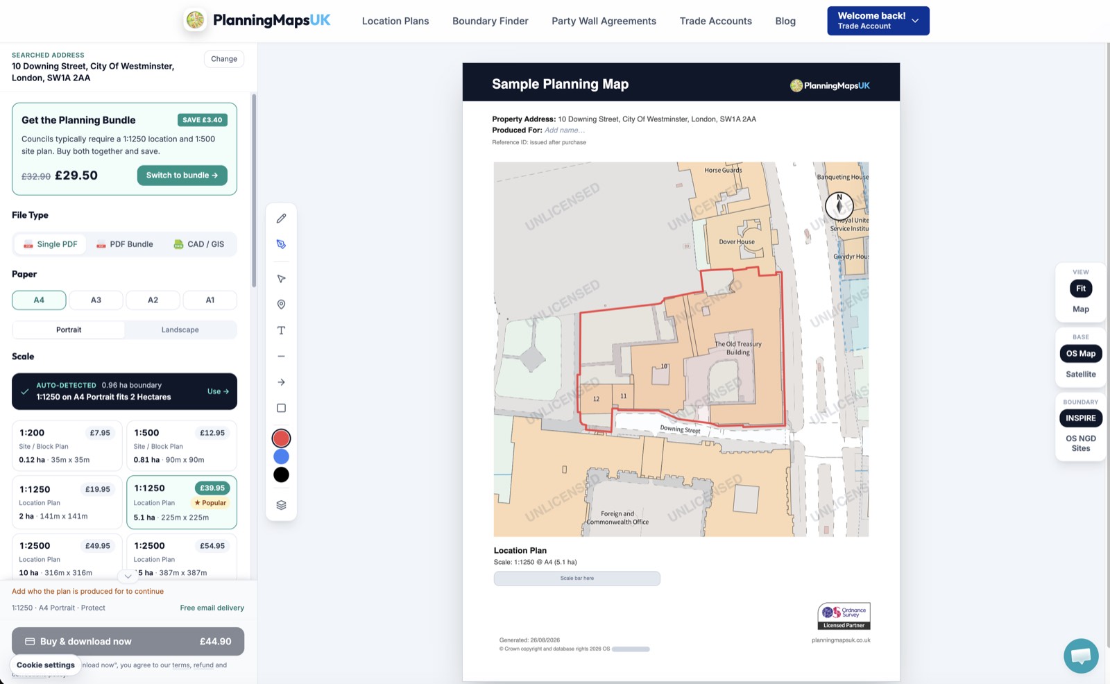
A new online mapping service aims to take the confusion out of sourcing the Ordnance Survey plans needed for planning applications.
PlanningMapsUK has launched a new online platform designed to help homeowners and property professionals obtain licensed Ordnance Survey mapping for UK planning applications and design projects.
For self-builders and renovators, the platform allows users to search for their property by address or postcode, identify the site, add planning boundaries and generate licensed mapping online. Plans can be produced in A4 or A3 format and downloaded following purchase.
The service supports commonly requested planning scales, including 1:1250 and 1:2500 location plans, as well as more detailed 1:200 and 1:500 block and site plans.
Site location and block plans are routinely required for planning applications covering projects such as extensions, loft conversions, new homes and outbuildings. PlanningMapsUK says its maps can include features such as red and blue site boundaries, surrounding roads, nearby properties and a north point.
The platform also offers editable Ordnance Survey CAD mapping for architects, designers, planning consultants, surveyors and developers. Files can be supplied in DWG and DXF formats, with British National Grid coordinates, while optional terrain and contour information is available where elevation data is required.
PlanningMapsUK says the service currently provides mapping across Great Britain, with plans to continue expanding its range of digital mapping products.

